Sanriku Coast
The coast from Miyagi prefecture north to Aomori is called Sanriku coast. Above all, from Kesennuma city in Miyagi prefecture to Kitajima beach in Kuji city in Iwate prefecture, it is designated as Richichu Kaigan National Park.
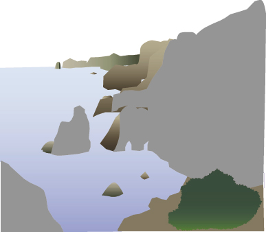
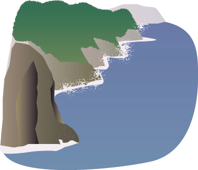
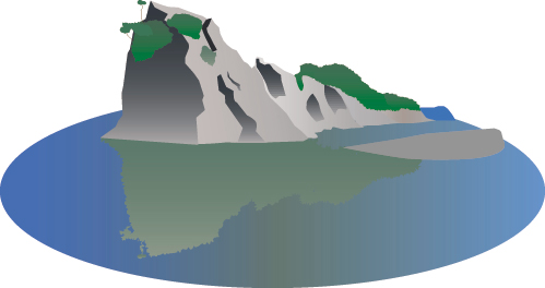
The intricate coastline is called the Rias style, and varied landscapes can be enjoyed from land and sea. Jodogahama is named for its 200 meter high cliffs, Kitayamazaki's cliff of a cliff and its beauty like a pure land. Off Sanriku is also known as one of the three major fishing grounds in the world, and you can also taste fresh, delicious fish in abundance and variety.
North limit sea girl (Kuji city)
The northernmost part of Rikuchu Coast, Kosode and Oshiri, is an Ama of the northernmost Honshu. In addition to being able to know the history and life of the Ama woman at the Ama Center located by the Kosode Coast, we are making demonstrations.
During the tourist season, there is a demonstration of bareback on the Kosode coast, and it is wonderful to see sea urchin, abalone, seaweed etc carefully. In the summer, the "Hotaru Ama Festival" will be held.
Eboshi Rock (Noda Village)
The Tofu cape coast, where the purple purple azuki sand is followed, is a scenic spot representing Noda village.
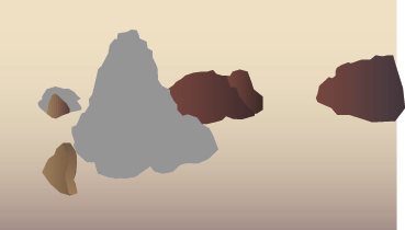
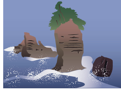
Just south of that, there is the Tamagawa Coast, where strange rock formations continue. Above all, "Eboshi rock" is particularly striking. The silhouette that floats up in the blue ocean is just like putting a cap on the sea.
Kitayamazaki (Tanobata village)
Speaking of the first scenic spot on the northern coast of Chugoku Coast, this Kitayamazaki is a representative point of view point that you can not miss by all means. The cliffs of 200 meters rise from the sea surface, and rough rock formations continue for eight kilometers, with many layers.
The grandeur of the view from the top of the cliff and the promenade down the coast, you will be even more impressed by the power of the light up at the sight of Bentensaki, where you can see the light. It should be able to add the color to the white spotted rhododendron that blooms only in three places on the coast of Honshu in June. A sightseeing boat of Kitayamazaki is out from Koshi Port on the island.
Koi no Sugao cliff (Tanobata village)
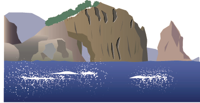
Along with Kitayamazaki, it is the cliff of the cliff that lets you feel the size of the scale of the Northern Riku Chuka coast in Tanohata village. The land suddenly drops to the sea at a height of 200 meters, and it is possible to see whether the topography where its cliffs form a regular five-layer row is refusing invasion as a place of human life.
The origin of the name of the spider's nest cliff is said to have come from the fact that the sea urchin forms many nests on the middle of the cliff. It is a great panorama that makes you realize that.
Akira Yoshimura, a writer, traveled this place on a young day and drew a plan for his early masterpiece, The Journey to the Star, and made it a work. A literary monument commemorating that is erected on the island of Yue.
Sannoiwa (Miyako City)
A rock with a height of 50m, a woman by the side, and a rock rock-shaped drum-shaped drum rock with three huge rocks rising from the sea. As you go down the promenade from Taro Fishing Port to the coast, the dynamic rock shape approaching is like a high-rise building.
It is said that good luck will come when you go through a sea cave on a rock. The rock formations of conglomerate and sandstone layers indicate the formation of these rock formations in the Cretaceous period. You can enjoy dynamic salmon fishing in the coast area, and you can catch Eri, Soi, Donko, Suzuki, Saba etc.
Shiobuki (Miyako City)
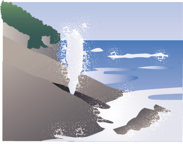
The "Shiobaido" designated as a national natural monument is located on the other side of Hiji Island. A rare natural fountain created by a 30 cm wide gap extending into the sea made of sloped Cretaceous rock formations. Every time a rough wave comes into the hollowed lower part, the height of the sea water that blows up with a roar and a tremendous momentum is as long as 30 m.
Pure Land Beach (Miyako City)
Tenwa 3 years (1683) A monk from Miyako Joanji who discovered this place, his name derived from the compliments of "Religiously Pure Land's Sacrifice", "Jyodogahama". White quartz rough rock is sharpened by the sea touch and sticks out to the highly transparent blue water surface.
The quiet bay with no waves is lined with strange sights such as Mt. Kenno, Ashinokawara, and Geikonoike, and the green contrast of Akamatsu and the sandy beach produce a superb contrast. There are rest houses, observation decks and nature trails in the area, and sightseeing boat trips to Jodogahama are also popular.
Todogaki (Miyako City)
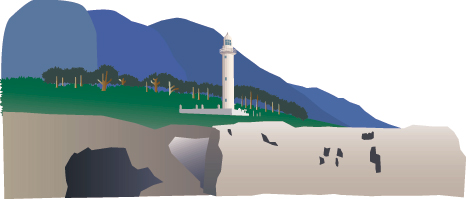
Located at the eastmost end of Honshu at 142 degrees 4 minutes 34 seconds east longitude, "Todogaki" is the eastern end of the Shigemo Peninsula.
In Honshu, you can watch the sunrise from the Pacific Ocean. It is popular as a hiking trail, and the area is one of Sanriku's leading fishing spots. The white lighthouse built in 1905, built on a cliff that stands up, is also known as the setting for the movie “Joy and Sadness,” which is modeled on a Taimori couple. The historically valuable lighthouse and its buildings are still active and continue to protect the safety of the people traveling the ocean.
Kamaishi Okannon (Kamaishi City)
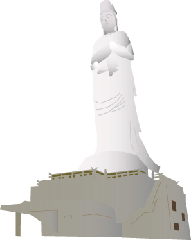
It is a 48.5 m tall, white fish-clad Kannon that stands toward Kamaishi Bay at the height of the tip of Amagasaki.
In 1955, Jodong Soseki Temple, located in Kamaishi City, was erected in prayer for the happiness of people. The interior is 13 floors and can be climbed by spiral stairs, and the 2nd to 10th floors are the 33rd Kannon and Everybody Kannon. It is an observation deck facing the
Shizukuishi Beach (Ofunato City)
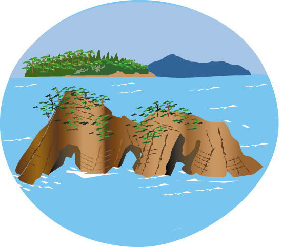
Antonji Pass, a landscape representing the Shizukuishi Coast, is a symbol of the southern land and the middle coast. It is a strange rock with three large holes in the base of the rock due to the erosion of seawater, which is a sculpture created by nature. Let's go through the tunnel where the power of the wave has gone through and get on the small sightseeing boat arriving and departing from Soishi coast.
Kashiwajima (Rikuzentakata City)
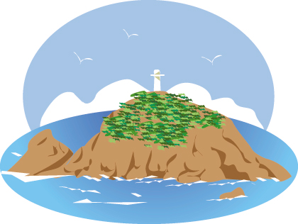
The tip of the Hirota Peninsula of Rikuzentakata City, the southernmost city in the coastal area of Iwate Prefecture, and the southernmost island of Iwate Prefecture, is designated as a national natural monument as a large breeding ground for sea cats. Therefore, landing on the island without permission is prohibited.
At the top of the Hirota peninsula are Aomatsujima and Kashiwajima, but once on the granite Kashiwajima, one large colony of Kashiwa was found. However, at the end of the breeding season, which reaches 800 to 100,000 of the sea cat in May and June, it has finally become a bare island.
There are other places where nestlings such as night owls and utako are separated from nests on the ground, sea eagles are branches on the ground, oysters are branches of eel, and は ト は is in the soil. "One step nesting of birds" on one island Can see.