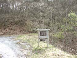
From the Taneyama Shichirizuka to the south while going around Sanmiyama, you will enter Sendai and the Morioka Territorial Territorial Territorial Territorial Territorial Territorial Terri either. Here is the Sakai Kaijizuka, which is described in the southern part of the setting sun according to the “Seta Yonemura Genroku-e” (Gen. No. 12/1699). In addition to this road, a stone crossing over the rock is drawn on the picture, and the route of the Kazaiku, Shizukuishi, Seta rice as a main road, a ginseng road (Kesen road) is shown in "Esashi city history 2" I'm raising. In the middle of that area, there is the Kuriki-Tetsuzan trace (prefective designated remains) developed from the end of the Meiji period to the middle of the Taisho period on the background of abundant timber resources of the Tanzan.